While the coronavirus pandemic is still going on, some places around the world are starting to reopen. To help you get around while COVID-19 is still happening, Google Maps is gaining some helpful new features.
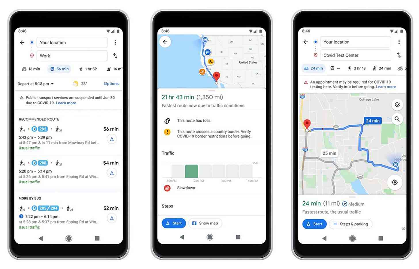
When you're looking up public transit directions for a trip that may be affected by COVID-19, Google Maps can now show you alerts from local transit agencies. These can include government mandates that impact services or a requirement to wear a mask on public transit.
These transit alerts are now rolling out in Argentina, Australia, Belgium, Brazil, Colombia, France, India, Mexico, Netherlands, Spain, Thailand, United Kingdom, and the US. More countries will be added soon.

Google Maps can also alert you about coronavirus checkpoints and restrictions along your route, like if you're crossing national borders. You'll see these driving alerts on your directions screen and after starting navigation. These alerts will be available in Canada, Mexico, and the US to start.
There are new alerts for medical facilities and COVID-19 testing centers, too. If you're navigating to one of these places, Google Maps will show an alert reminding you to verify your eligibility for these locations so you can avoid being turned away. Alerts for medical facilities are rolling out this week in Indonesia, Israel, the Philippines, South Korea, and the US, and testing centers alerts are also available in the US.
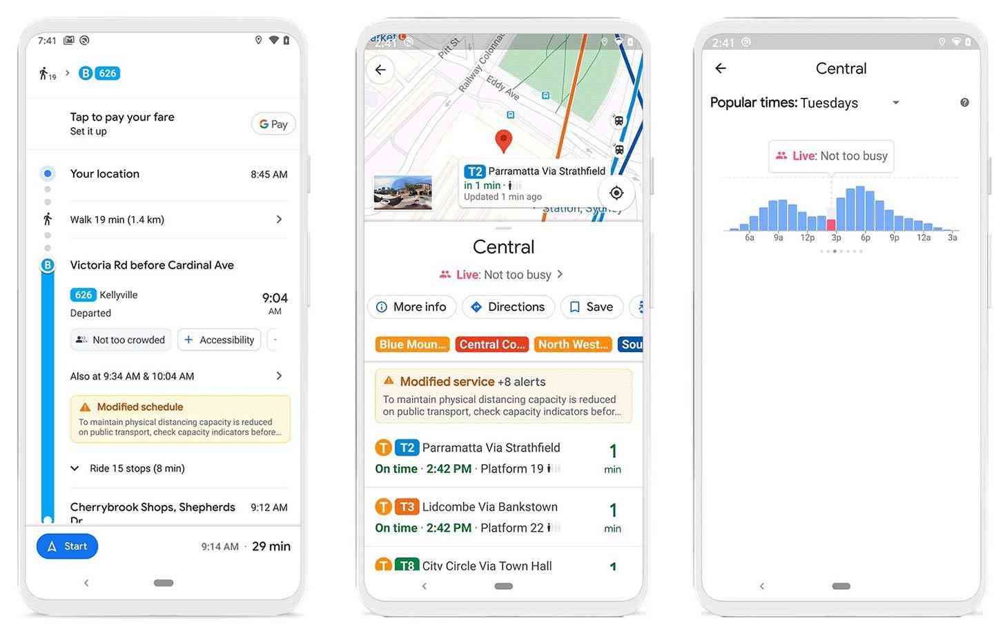
Google is also making improvements to help you know what a particular bus or train is going to be like before you get on. For example, Google is making it easier for you to contribute crowdedness information for public transit, a feature that first rolled out last year. Just look up directions, tap through to Transit Details, and scroll down to crowdedness predictions.

Google Maps has now rolled out insights like temperature and security onboard to all users globally. Also rolling out is improved accessibility info such as wheelchair accessible doors, seating, and stop buttons. You can find these notes alongside the public transit route info and you can submit your own info to help others.
Finally, you'll start to see the times when a transit station is typically more or less busy. You can also see live data to find out exactly how busy a station is right now. Just search for a particular transit station on Google Maps. This info is starting to roll out today and will continue to begin appearing over the next several weeks.
All of these new features are making their way to Google Maps on both Android and iOS.