Google Maps is a hugely popular app that many people rely on to help them find their way around and better understand areas that they're not familiar with. And now it's getting more detailed to give you even more information.
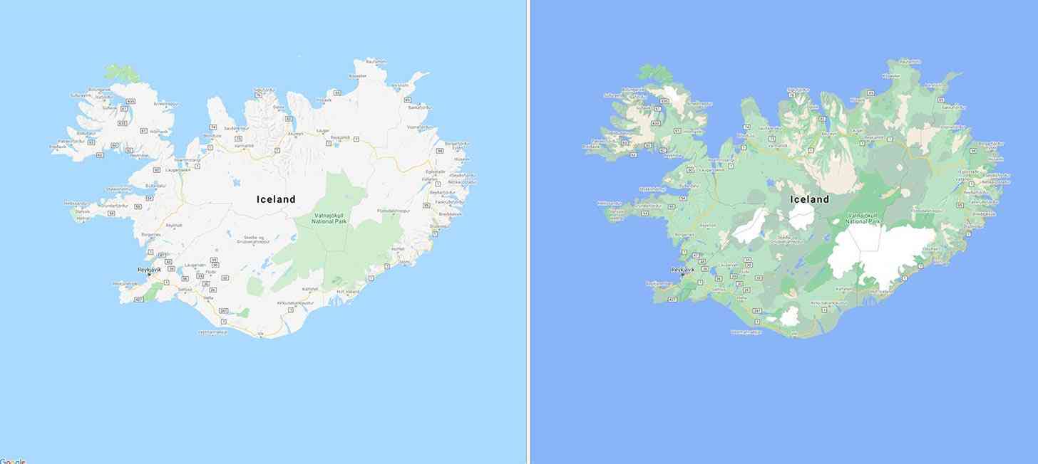
Google is rolling out more comprehensive, vibrant maps that better show the natural features of the land. For example, you can better get an idea of how much green vegetation is on the land, and you can more easily see if an area has a tall, snow-capped mountain.
You can see a before and after comparison of Iceland above that shows much more greenery throughout the country as well as a more easily identifiable Vatnajökull, Iceland's largest icecap that's now shown in white.
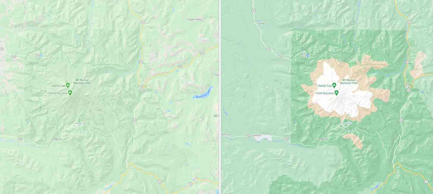
Mt. Rainier National Park will now better show its mountain ridges, white snowcap, and vegetation, too, and the borders of the national park are now clearly defined using a darker shade of green.

Google has achieved these more detailed maps using a color-mapping algorithm. This involves identifying natural features from satellite imagery, looking specifically at arid, icy, forested, and mountainous regions. Those features are then assigned colors on the HSV color model, like dense forests getting a darker shade of green than a patch of shrubs.
These visual improvements are rolling out in Google Maps this week.
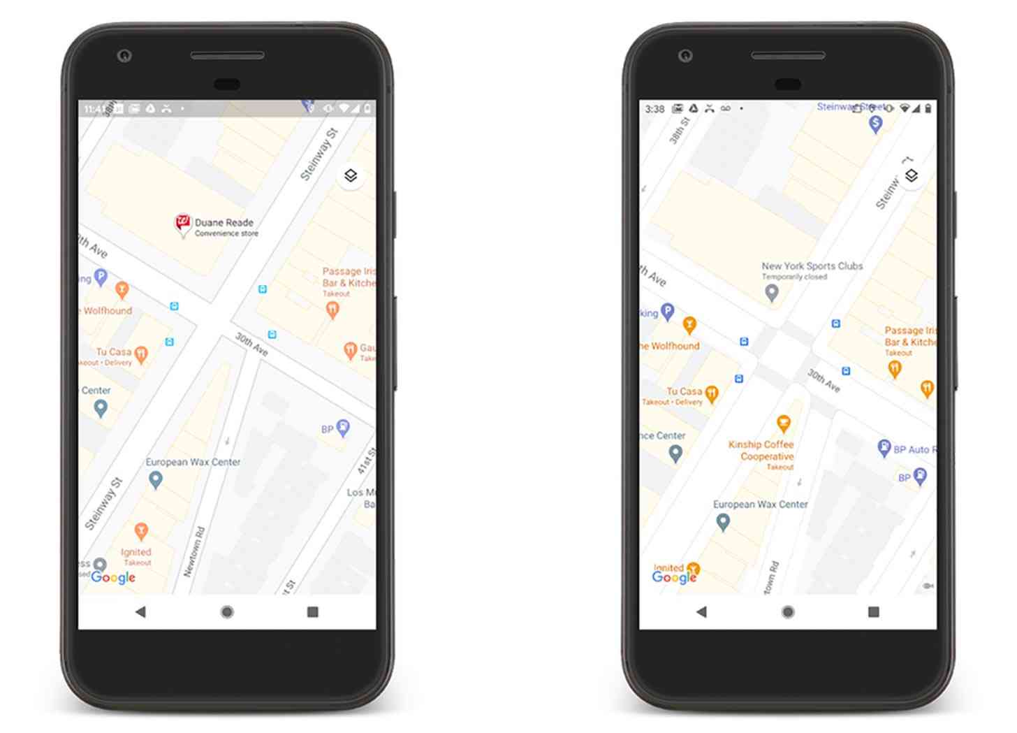
Folks who use Google Maps to get around in more urban environments are getting more detailed maps, too. This update will offer more highly detailed street information, including the accurate shape and width of a road to scale.

You'll also see exactly where sidewalks, crosswalks, and pedestrian islands are located to help you better figure out how to safely get around trafficked areas.
These more detailed street maps will begin rolling out in New York, San Francisco, and London in the coming months and will expand to more cities over time.