Google Maps has been gaining some awesome features to help drivers lately, and now another great feature is making its way to more users.
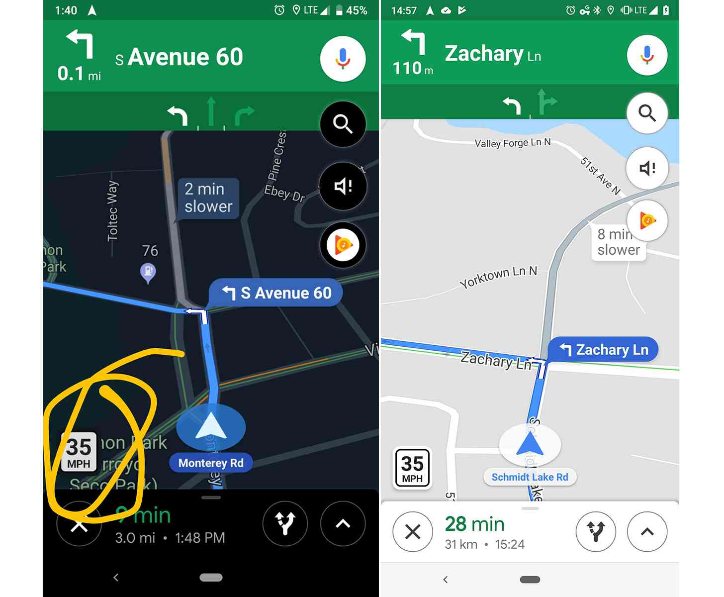
Speed limits are going live for more Google Maps users across the U.S. The feature originally launched way back in July 2017, but only in the San Francisco Bay Area and Rio de Janeiro, Brazil. Fast-forward to today and Google Maps users in New York City, Los Angeles, and Minnesota all tell Android Police that they, too, now have speed limit info.
When enabled, Google Maps will show a small speed limit sign in the lower left of the map when you're navigating.
Having speed limits appear in Google Maps while you're driving is a great help. While speed limits are posted on signs along the road, it's possible that you might miss a sign or not see one for a while when you turn onto a new road. This Google Maps feature ensures that you know the speed limit for the road you're driving on at all times.